


Watarrka National Park, synonymous with Kings Canyon, includes the western end of the George Gill Range. This scenic landscape of rugged ranges, rockholes and moist gorges acts as a refuge for many plants and animals. This makes the Park an important conservation area and a major visitor attraction in Central Australia. The traditional custodians of this land, the Anangu, believe the Central Australian landscape was created at the beginning of time by their ancestors. Their descendants have been protecting these sacred lands for thousands of generations since.
Access
1. The Park is located southwest of Alice Springs and can be reached via a number of routes:2. via Larapinta Drive through the West MacDonnell National Park. A Mereenie Loop pass
is required to travel this route and is available from the Alice Springs Tourist Information
Centre, Glen Helen Resort and Kings Canyon Resort.
3. via the Stuart Highway, Ernest Giles Road (4WD essential) and Luritja Road.
Watarrka National Park TripsThe Watarrka National Park is accessible all year round. The cooler months (April to September) are the most pleasant. Overnight camping in tents or campervans is not permitted in the National Park. Commercial motel and camping accommodation is the only option available for visitors wishing to stay overnight at Watarrka.
Walking
Before undertaking any of the following walks, consider your personal health, fitness andavailable time. Visit the Safety Information Shelter and check the temperature gauge at the start of the Canyon walks.
The Kings Creek Walk
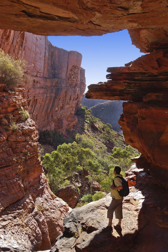
(2.6 km, one hour return). The gentle slope of the track meanders up Kings Creek to a lookout point. This walk is suitable for families. Wheelchairs can access the first 700 metres.The Kings Canyon Rim Walk(6 km loop, 3-4 hours). After an initial steep climb the walk offers spectacular views from the
Canyon rim. Along the way are the weathered, buttressed domes of the ‘Lost City’ and the sheltered ‘Garden of Eden’ with permanent waterholes and lush vegetation. This walk is suitable for fit, experienced walkers. For safety reasons, the track must be walked in a clockwise direction. This minimises traffic congestion, track erosion and vegetation degradation.

Kathleen Springs Walk
(2.6 km, 1.5 hour return) leads to a delightful spring-fed waterhole, suitable for families and accessible to wheelchairs.
The Giles Track
(22 km, 2 days) traverses the top of the range from Kathleen Springs to Kings Canyon with a halfway entrance/exit point at Reedy Creek/Lilla. Notify a reliable person of your intended walk plans and ensure they know to contact police if you do not return by the arranged date. Carry a satellite phone or personal locator beacon.


0 comments:
Post a Comment